
Try EarthPlat Free for 7 Days
Access accurate Florida parcel boundaries, ownership records, sales, acreage, zoning, reports, raw data, KML and more.
No commitment. Cancel anytime.
- Monthly Plan
$9.95p/m
- Free Trial / Monthly
- Mobile app Access
- Desktop Access
- Yearly Plan
$99p/y
- Free Trial / Yearly
- Mobile app Access
- Desktop Access
- Volume License
15%off
- Mutiple User Access
- Per user discount (3 min)
- Up to 50 Accounts
Powerful Tools Built for Florida Property Research
EarthPlat combines GIS mapping, parcel data, saved groups, and printable reports into one powerful platform.
Hybrid Boundary View
Satellite imagery with precise parcel overlays and measurements.
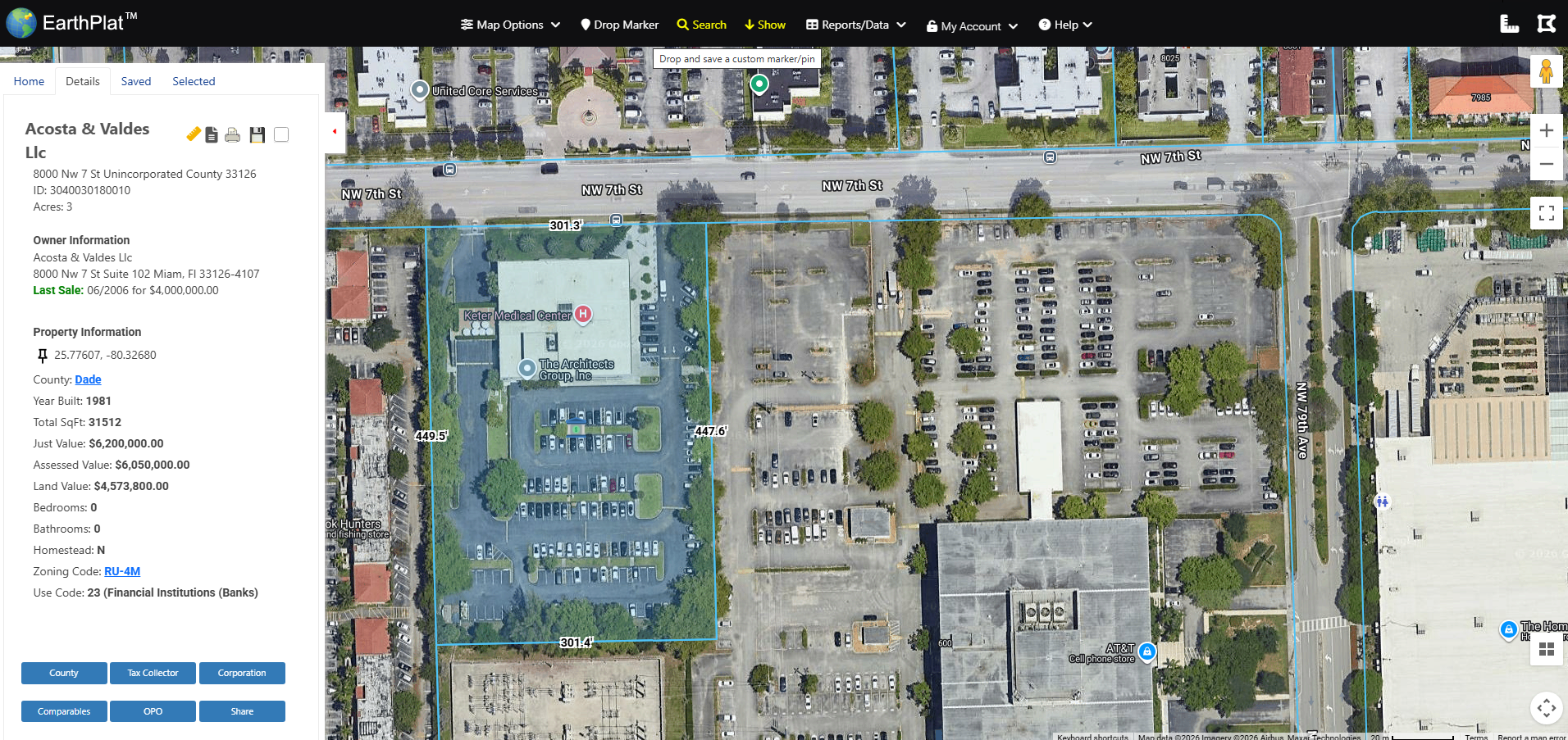
Interactive Property Details
Owner info, value breakdown, zoning, and parcel data in one place.
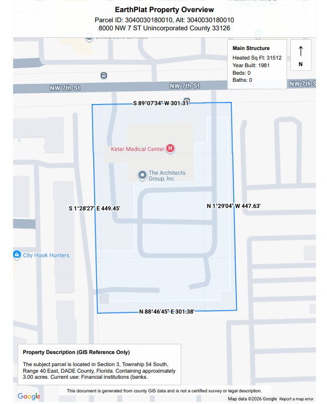
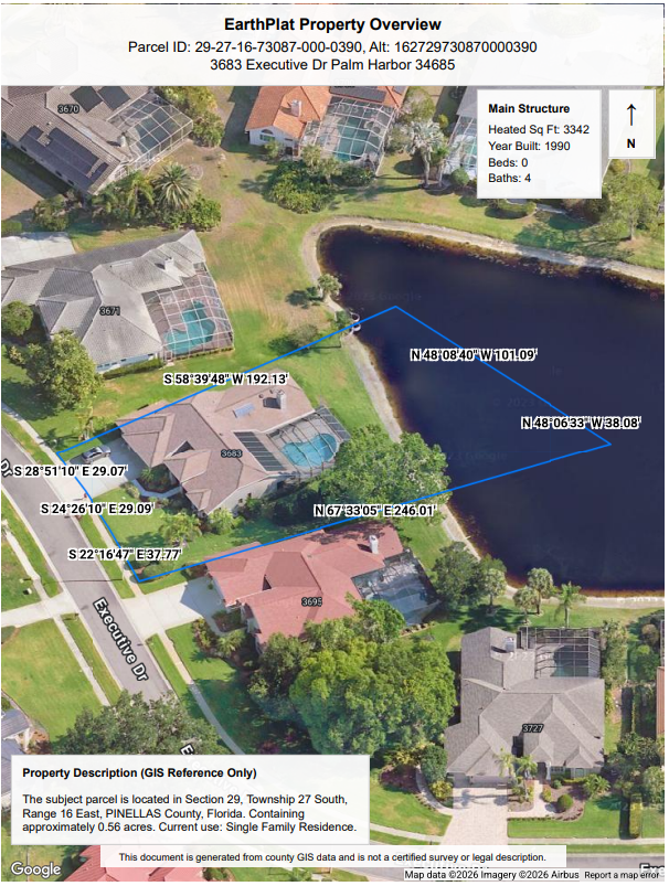
Printable GIS Plan
Clean professional boundary reports for documentation.
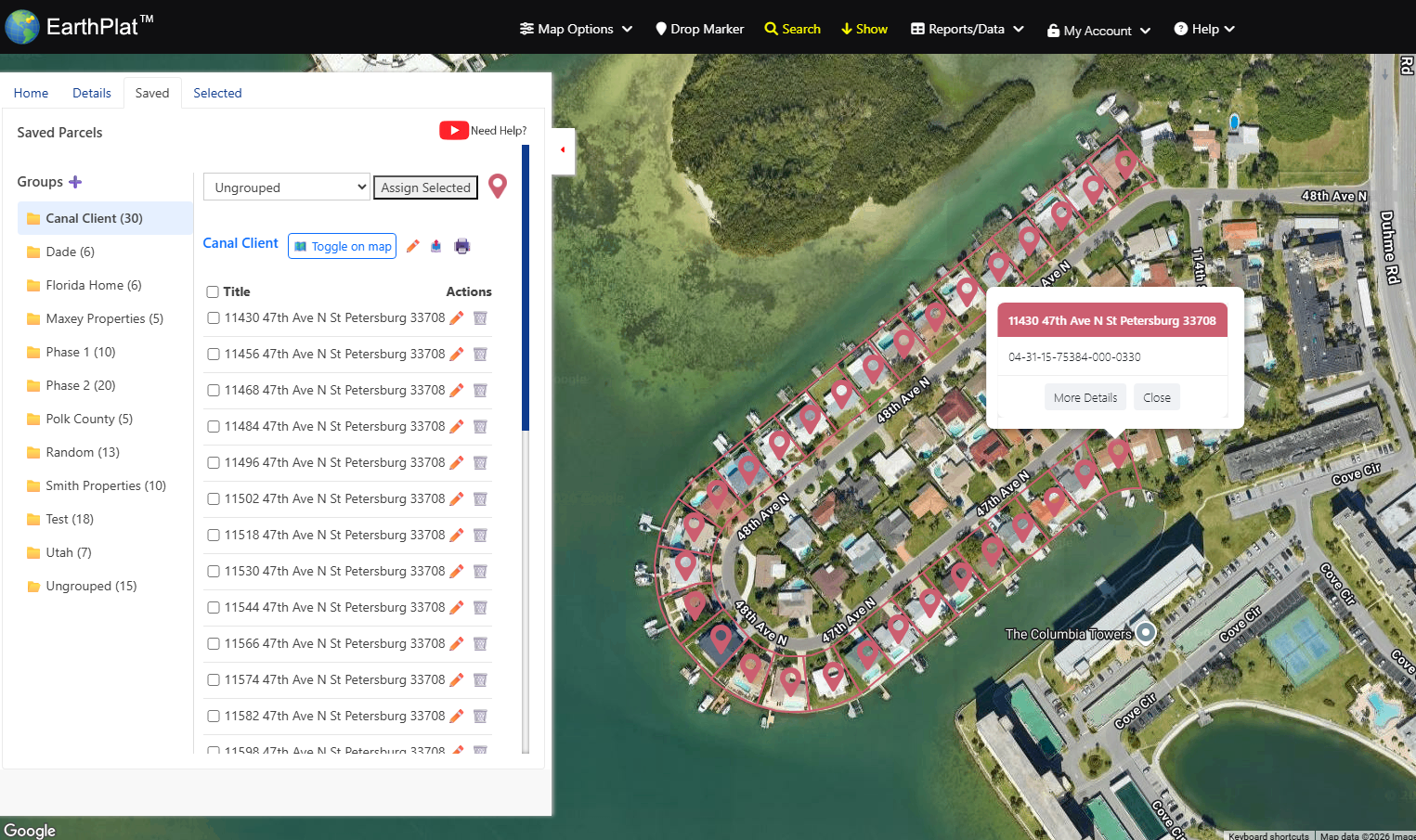
Saved Parcels & Groups
Organize properties into custom groups for clients or projects.
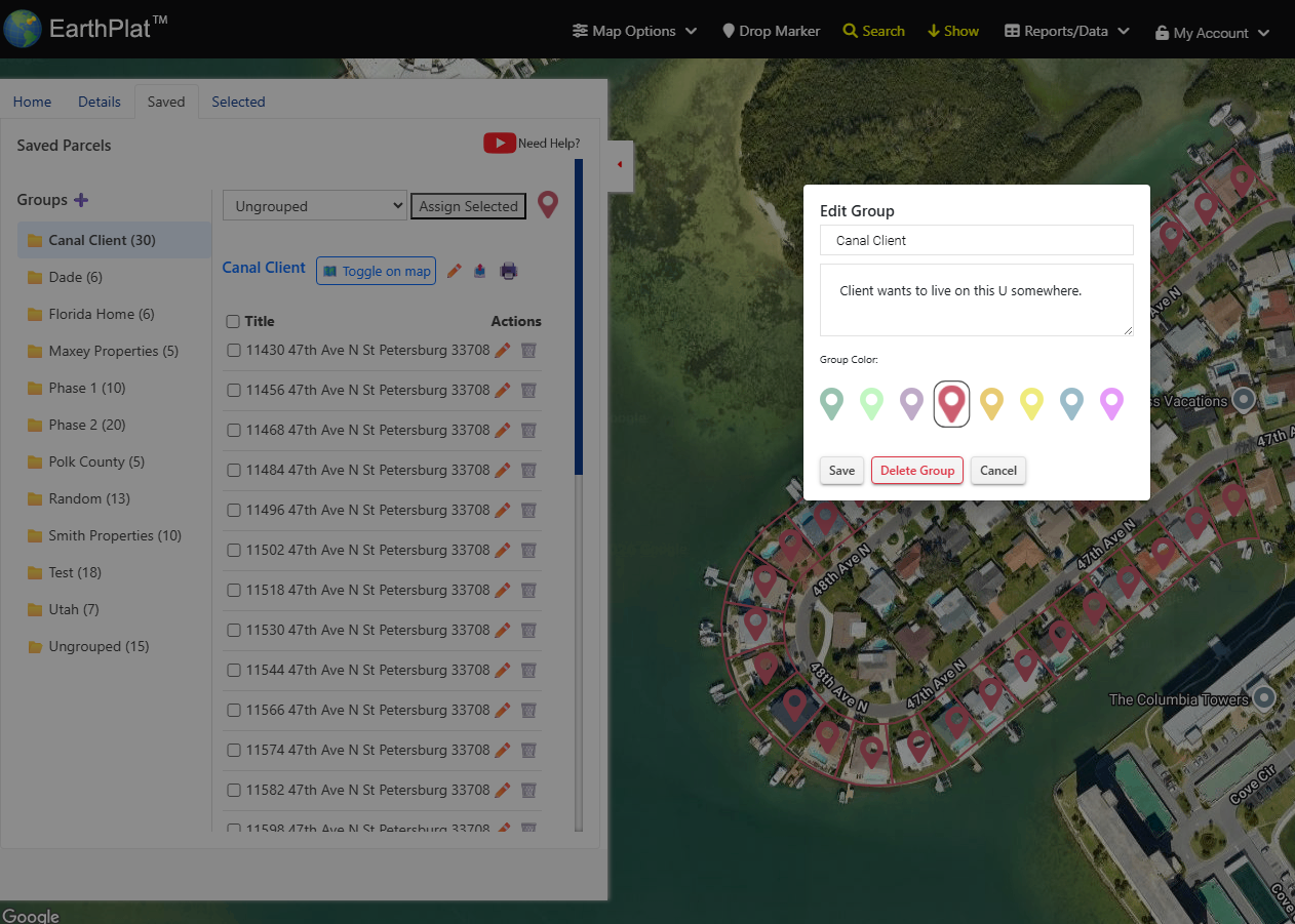
Group Color Coding
Assign colors and notes to organize parcels visually on the map.
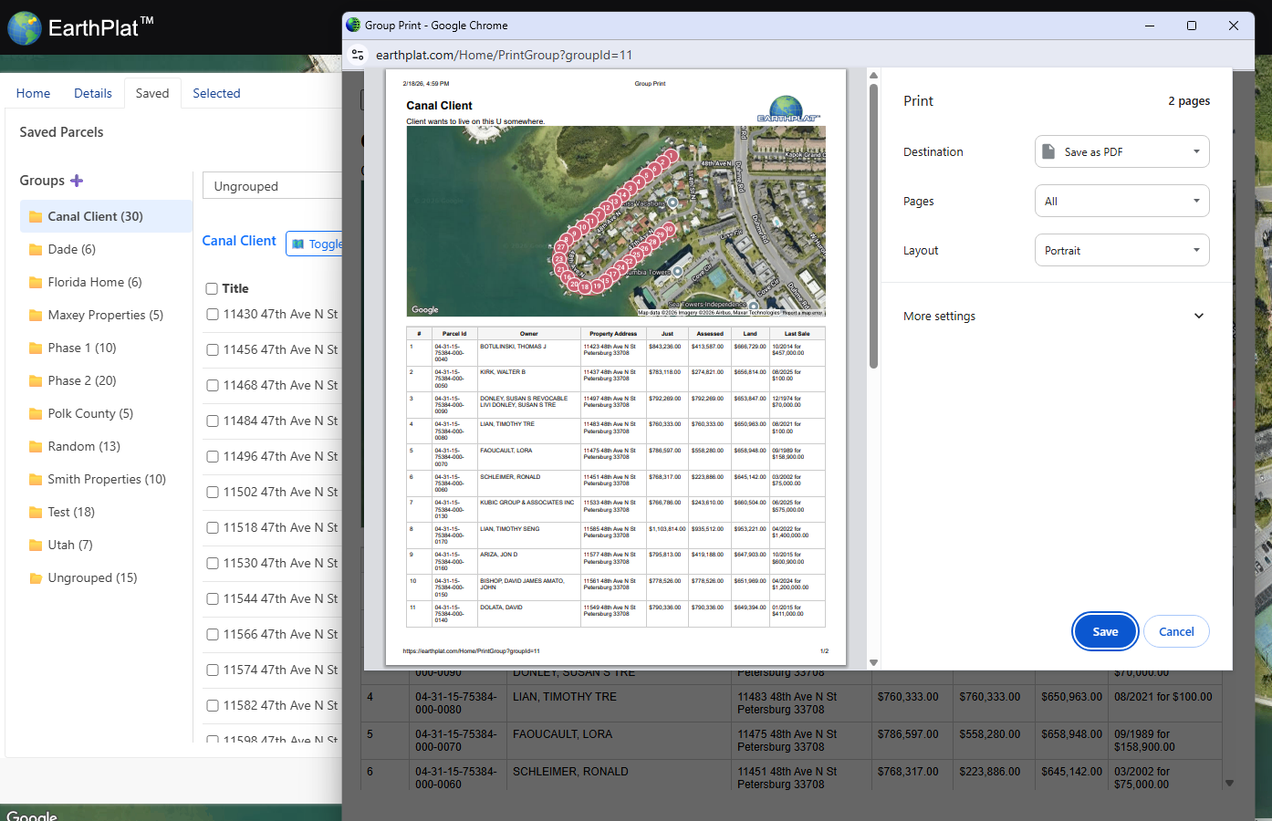
Printable Group Reports
Generate multi-parcel reports with maps and property tables.
Find Property Owners
- Owner name & mailing address
- Search by address or parcel ID
- County-sourced ownership records
- Export raw data
Analyze Property Value
- Land & building value breakdown
- Sales Information
- Square footage & year built
- And more...
Professional GIS Mapping
- County gis parcel boundaries
- Acreage calculations
- Interactive map layers
- Generic Site Plans
Florida Property Lines & Parcel Data
EarthPlat provides GIS-based property boundary and parcel data across all 67 Florida counties. Whether you are researching land ownership, evaluating property value, or verifying acreage, EarthPlat delivers fast, accurate results directly from county sources.
Our mapping tools allow you to search by address, owner name, or parcel ID and instantly view detailed property records, including assessed value, land breakdown, and sales.
Serving the following states: Florida
© 2026 TMAIDA INC. EarthPlat® is a registered trademark of TMAIDA INC. All rights reserved.